🎧 Listen to my travel diary:
For further reading: I’d recommend checking out Wikipedia’s page on Muscat for deeper historical and factual context.
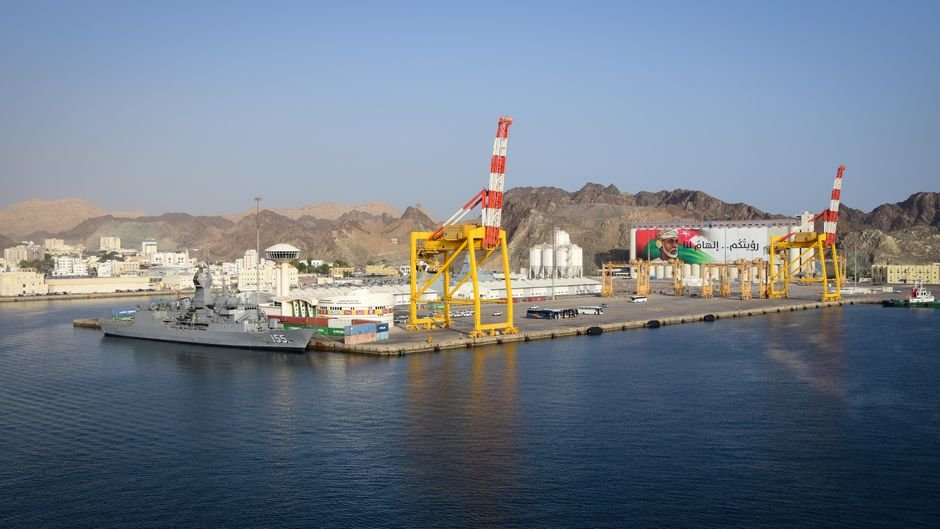
Good morning from Muscat, Oman, where the Forgotten Trade Routes still leave their mark on the stone underfoot, if you know where to look. Right now I’m standing near the old Muttrah waterfront, watching an elderly man untangle a fishing net while the Al Jalali fort sits up on its rock, grey and squat against the hills. The air smells of salt and diesel from the dhows. Frankincense drifts over from a shop doorway. That resin smell is the whole point here—it’s what moved through this port for centuries.
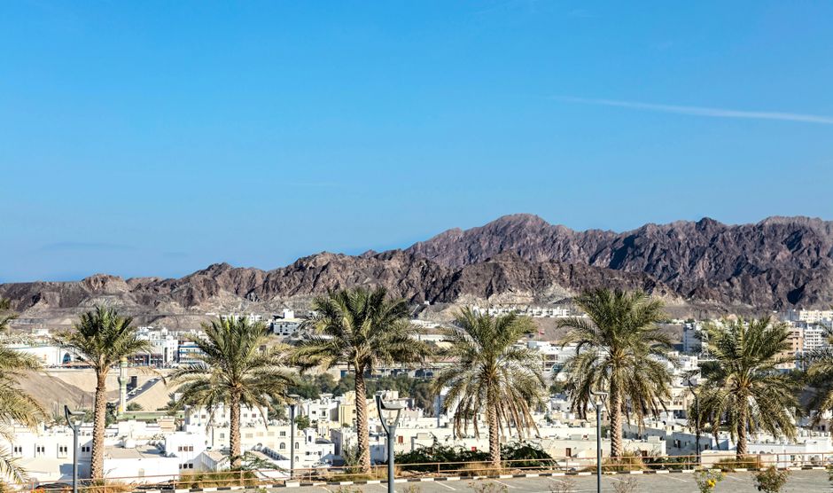
I flew in on Oman Air. The approach over the Hajar mountains tells you everything about why this place mattered. Jagged, bare rock. No soft landings. Muscat sits where the mountains meet the Gulf of Oman, and that geography made it a natural stop for ships and caravans both.
I came here to trace the old waystations. The caravanserai logic. Where merchants stopped, where they watered their animals, how they kept raiders off their backs. The falaj irrigation channels are part of that story. So are the thick mud-brick walls and the watchtowers you see scattered through the wadis inland.
Today did not go to plan. I had a route mapped toward the older quarters. Then the sky opened. A proper tropical downpour, the kind that turns dry wadis into fast brown water in minutes. People here take it seriously—flash floods kill. I ducked into a tiny bookstore off a side lane near the souq. No name on the door that I could read.
Two hours in there. The owner made tea. He had old maps, water-stained, showing the caravan stops between the coast and the interior. He pointed at Nizwa, at the old forts, at the cistern systems that kept stored water clean through brutal summers. He explained the defensive building—how the mud-brick waystations had single narrow entrances, how the walls were deliberately thick, how watchmen sat above the gates.
The rain hammered the tin roof the whole time. I could hear water rushing in the gutters outside. The books smelled of damp paper and dust.
That detour taught me more than my planned walk would have. This diary follows the physical remains of commerce through Muscat—the stone, the water, the defensive mud-brick. The real stuff that merchants trusted their lives to.
💻 The Nomad’s Tech Stack
A question I get a lot: how does this blog stay online while I’m bouncing between time zones? The answer is Hostinger. It’s fast, dependable, and never lets me down even when I’m syncing huge photo batches from the middle of nowhere.
💡 Traveler’s Pro Tip: This is one of those lessons I only learned after a few rough experiences. Now, I always rely on SEARADAR for renting yachts and boats with professional concierge support. It eliminates so much unnecessary stress when you’re on the road.

Tracing the Forgotten Trade Routes Beyond the Capital’s Edge
I started before sunrise. The air was still cool, the kind that doesn’t last past eight. My plan was simple: a 3-day inland loop following the old overland corridors that once fed goods into the coast. No tour. Just a rented Toyota Yaris from a local outfit near Al Ghubra, pulling 14 OMR a day, and a tank of fuel that cost less than a decent lunch back home.
The first stone waystation I reached sat off the Bidbid road. Weathered. Low. The kind of structure you’d drive past without a second look. But these waystations marked the spine of the Forgotten Trade Routes that linked the interior plains to the sea. I ran my hand along the wall. The stone was rough, pitted, warm already from the early light. Smelled of dust and dry grass. Insider Tip: fuel up fully before leaving the city. Stations thin out fast past Fanja, and the last reliable pump I saw charged standard rate, no markup, but closed by evening.
Documenting the Weathered Waystations and Their Defensive Stonework
I shot tight frames with the full-frame body and the 35mm prime. Nothing wide. Just grounded detail. The eroded corners. The way the masons packed rubble between the facing stones. These structures weren’t decorative. They were defensive. Thick lower courses. Narrow openings. Built so a handful of merchants could hold out against raiders who worked the dry passes.
The construction tells you everything. The walls taper. Heavier at the base, lighter up top. That’s load management without engineers. Just centuries of knowing what collapses and what holds. Inside one waystation, the floor dropped into a storage pit, cool even at midday. You could feel the temperature shift the moment you stepped down. This is the practical genius behind the Forgotten Trade Routes: shade, storage, and safety bundled into one squat building.
I spent an hour at a single doorway. The light moved. The shadows sharpened the chisel marks. No crowds. No ticket booth. Just me, the heat building, and a goat herder who waved from a ridge. Insider Tip: carry two litres of water per person minimum. There’s no shop, no stall, no vending machine anywhere near these sites. I learned that the dry way.
Comparing the Coastal Capital With the Quieter Inland Rival
Here’s the honest comparison. The capital draws the crowds and the cruise traffic. But if you’re chasing the actual substance of the Forgotten Trade Routes, the inland settlement of Bahla gives you more for less. Fewer visitors. Older stonework. And the entry costs are negligible compared to the polished coastal attractions.
Why choose this over the obvious tourist circuit? Numbers. A coastal All-Inclusive resort near the beach strip runs 90 to 130 OMR a night, half of which you spend on buffet food you won’t finish. Inland, I stayed in a modest guesthouse and ate for under 3 OMR at roadside spots serving fresh khubz and grilled meat. The bread came off the iron plate blistered and smoking, torn by hand, no cutlery. That’s the trade-off. Polish versus substance.
For accommodation I booked the Jibreen Hotel inland, clean and functional at roughly 28 OMR per night. Reception handled my late check-in without fuss. The man at the desk drew me a route map by hand, marking two waystations I’d never have found alone. That kind of hospitality you don’t buy at a resort. He didn’t push extras. He just helped.
Mapping the Water Systems That Kept the Caravans Alive
No water, no trade. Simple. The entire logic of the Forgotten Trade Routes depended on reliable stops where animals could drink and men could refill. I traced a stone-lined channel cut into a slope, feeding a collection basin downhill. The engineering was precise. Gentle gradient. Steady flow. No pumps, just gravity and patience.
The basin still held a shallow layer of water, green at the edges, cold to the touch. Dragonflies worked the surface. The sound was faint but constant, a trickle you only hear once you stop moving. I sat on the lip and ate dates from a bag I’d bought that morning. Dense. Sticky. Caramel-heavy. The best fuel for a day like this.
The defensive layout around the water made sense here too. Controlling the well meant controlling the route. Whoever held the basin set the terms. That’s why the old builders of the Forgotten Trade Routes placed their strongest walls nearest the water, not the road. Insider Tip: visit between November and February. I came in the shoulder window and the midday heat was manageable; by late spring these inland basins bake and the drive becomes a genuine endurance test. Check the regional transport updates before committing to the inland loop, as road closures after rare rain do happen.
By late afternoon I turned back toward the coast. Three waystations documented. One water system mapped. Dust on everything, including the lens hood. The light went amber over the dry hills, and the road ahead emptied out completely.
Final Entry: The Weight of Stone and Silence
The last waystation sat off the inland track, half-swallowed by gravel. I crouched by the base of the wall and ran my fingers across the surface. The construction was deliberate. Thick walls, angled slightly inward, built to hold cool air and keep raiders guessing. You could see where merchants once sheltered. The floor still held the shape of worn thresholds.
The water collection setup was the real engineering. A sunken reservoir, plastered tight, fed by channels that caught the rare downpour. Centuries of traders depended on it. No water meant no passage. Simple math out here.
The Forgotten Trade Routes were never romantic. They were logistics. Men moved goods because the alternative was poverty, and they died when the arithmetic failed.
Here is today’s hard lesson. The 4×4 rental ran me 28 rials a day, but the real cost was the unpaved approach roads. Nobody tells you the last stretch to these sites eats your suspension. I lost two hours backtracking after a track vanished into loose scree. Budget for the time, not just the fuel. Fuel was cheap. My patience was not.
I ate flatbread and lentils from a roadside stall for under a rial. The air-conditioned resorts back toward the coast charge thirty times that for a buffet nobody remembers. The stall owner remembered me. That is the trade.
The Forgotten Trade Routes taught me that endurance was the only luxury worth anything here.
Tomorrow I head back toward Ruwi. The old commercial quarter still carries the logic of these corridors. Spice shops, textile traders, the descendants of the caravan economy packed into narrow streets. I want to see where the desert track finally became a city. Where stone gave way to shopfronts.
More from my travel diary:
Share This Diary Entry
Disclosure: This post may contain affiliate links, meaning I get a commission if you decide to make a purchase through my links, at no cost to you.
Note for readers: Written for entertainment and general insight only. Local laws, advisories, and transport details change, so confirm them independently before your trip. Affiliate links may appear on this page.